Vijayawada
Vijayawada, NTR district, Andhra Pradesh: PIN codes, STD code 0866, climate, landmarks, how to reach, colleges and hospitals.
Facts last checked
Quick facts
- State
- Andhra Pradesh
- District
- NTR
- Language
- Telugu
- River
- Krishna
- Elevation
- 11 m
- Area
- 61.88 km²
- Population
- 10,34,358 (2011)
- STD code
- 0866
- Vehicle registration
- AP-16 (older series), AP-39 and AP-40 (newer series)
- RTO office
- Labbipet
- PIN codes
- 520001 to 520015
- Time zone
- IST (UTC+05:30)
- National highways
- NH 16, NH 65, NH 30
- Railway
- Vijayawada Junction (BZA)
- Airport
- Vijayawada Airport, Gannavaram (VGA)
Map of Vijayawada
Schematic plot to scale: north is up, rings mark 5, 10 and 15 km from the centre. Roads and rivers are not drawn. Tap the button for the full map.
| Landmark | Direction | km |
|---|---|---|
| 1Gandhi Hill | NW | 0.2 |
| 2Vijayawada Junction (BZA) | W | 1.2 |
| 3Mogalrajapuram Caves | SE | 2.3 |
| 4Kanaka Durga Temple, Indrakeeladri | W | 2.7 |
| 5Prakasam Barrage | SW | 2.7 |
| 6Gunadala Matha Shrine | E | 3.1 |
| 7Bhavani Island | W | 3.8 |
| 8Gunadala Railway Station (GALA) | NE | 5.0 |
| 9Undavalli Caves | SW | 5.6 |
| Kondapalli Fort | NW | 15.1 |
| Gannavaram Airport (VGA) | E | 17.8 |
About Vijayawada
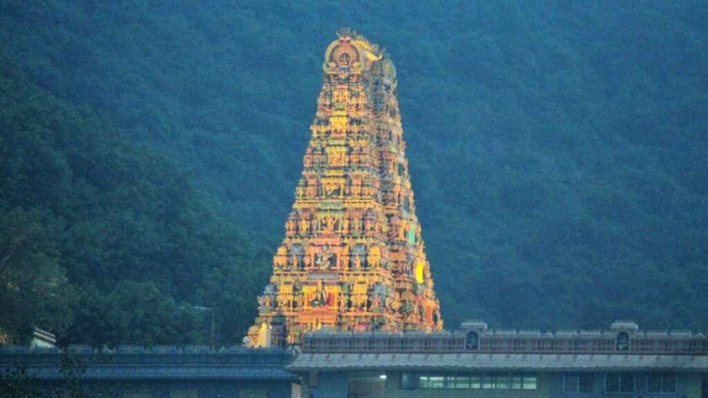
Vijayawada is the headquarters of NTR district in Andhra Pradesh. It stands on the Krishna River, where the Prakasam Barrage connects NTR district with Guntur district, and the Kanaka Durga Temple sits on Indrakeeladri hill above the river.
The 2011 census counted 10,34,358 people in the city, which is governed by a municipal corporation with 77 wards. Telugu is the local language.
How to reach Vijayawada
By rail
- Vijayawada Junction (BZA)1.2 km W
- Gunadala Railway Station (GALA)5.0 km NE
By air
- Gannavaram Airport (VGA)17.8 km E
By road
National highways: NH 16, NH 65, NH 30
Distances are in a straight line from the city centre, not by road. Vijayawada Airport is at Gannavaram. The national highways NH 16, NH 65 and NH 30 serve the Vijayawada area.
Climate of Vijayawada by month
May is the hottest month, with an average high of 40.2 °C. The coolest nights are in January, with an average low of 18.5 °C. July is the wettest month (207.7 mm) and about 1,032 mm of rain falls in a year.
| Month | High °C | Low °C | Rain mm | Rainfall bar |
|---|---|---|---|---|
| Jan | 30.4 | 18.5 | 5.8 | |
| Feb | 32.8 | 20.0 | 10.4 | |
| Mar | 35.9 | 22.7 | 11.0 | |
| Apr | 37.9 | 25.3 | 17.2 | |
| May | 40.2 | 27.3 | 63.0 | |
| Jun | 37.2 | 26.7 | 138.3 | |
| Jul | 33.9 | 25.4 | 207.7 | |
| Aug | 33.0 | 25.1 | 180.5 | |
| Sep | 33.2 | 24.9 | 170.3 | |
| Oct | 32.4 | 23.8 | 150.6 | |
| Nov | 31.4 | 21.4 | 60.5 | |
| Dec | 30.4 | 18.9 | 16.7 |
Source: India Meteorological Department normals for Vijayawada Airport (Gannavaram) station, 1991 to 2020, as published on Wikipedia.
Census figures (2011)
- Population
- 10,34,358
- Males
- 5,18,590
- Females
- 5,15,768
- Sex ratio
- 995 females per 1,000 males
- Density
- 16,716 per km²
Vijayawada city (municipal corporation), Census 2011 provisional totals. Including outgrowths the 2011 population is 11,43,232 (Registrar General of India). Literacy is left blank because published figures differ (81.24% and 82.59%); take it from the official Census of India tables.
Pin codes of Vijayawada
| PIN | Post offices and areas |
|---|---|
| 520001 | Vijayawada GPO, Chittinagar, Railway Junction, Winchipet |
| 520004 | Gunadala |
| 520010 | Labbipet |
| 520011 | Satyanarayanapuram, Besant Road |
| 520012 | Bhavanipuram |
| 520013 | Krishnalanka, Pandit Nehru Bus Station |
| 520015 | Azitnagar, Payakapuram, Patamata Lanka |
Frequently asked questions
What is the STD code of Vijayawada?
The STD code of Vijayawada is 0866.
What is the main PIN code of Vijayawada?
The head post office, Vijayawada GPO, uses PIN code 520001.
Which river flows through Vijayawada?
The Krishna River flows along the city, and the Prakasam Barrage crosses it.
Which is the hottest month in Vijayawada?
May, with an average daily high of 40.2 °C (IMD normals for 1991 to 2020).
Localities in Vijayawada
Source: Wikipedia; census2011.co.in; citypopulation.de (Registrar General of India); India Post PIN listings; NTR District website; checked 30 and 31 Oct 2026
Thank you. Your report was sent.
Please wait a minute before sending another report.